
SRN Boundaries
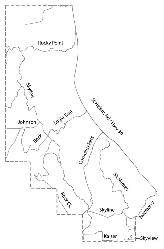
SRN encompasses the northwestern portion of Multnomah County, Oregon. Our boundaries are roughly as follows: Hwy. 30 on the east, Newberry Rd to Kaiser Rd. on the south, the Washington Co. line on the west and the Columbia Co. line on the north. For a more detailed description of SRN’s boundaries, see Article 1 of the Bylaws.
Skyline Area Wall Maps for Sale
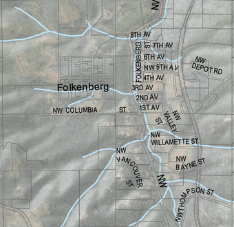
You can purchase a printed copy of the full color wall map produced for SRN by Metro. See the sample at right.
It measures 34 X 44 inches and shows street names, topography, water features and parcel boundaries overlaid over an aerial photo. Printed on durable paper (not mounted or laminated).
Mail a check payable to SRN for $30, along with your name, address, phone number and email, to Rachael Brake, SRN Treasurer, 14109 NW Rock Creek Rd., Portland, OR 97231